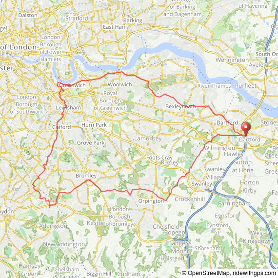
A very chilly 42.5 mile loop over SE London today, 'nippy-around-the'nads' I'd describe it as. I wanted to investigate the Waterlink Way route that goes from the Cutty Sark down through Catford to Elmers End and beyond, managed to go way past desired stopping point and had to rely on the Garmin to get be back home as I didn't know where I was, ooops!
Distance: 42.5 mi
Elevation: + 2486 / - 2506 ft
Max Grade
13.2 %
Avg. Grade
-0.1 %
VAM 447 Vm/h
Ascent time 01:41:41
Descent time 01:27:31
Total Duration: 03:38:51
Moving Time: 03:11:48
Stopped Time: 00:24:02
Max Speed: 32.4 mph
Avg. Speed: 13.4 mph
Pace: 00:05:04
Moving Pace: 00:04:30
A very chilly 42.5 mile loop over SE London today, 'nippy-around-the'nads' I'd describe it as. I wanted to investigate the Waterlink Way route that goes from the Cutty Sark down through Catford to Elmers End and beyond, managed to go way past desired stopping point and had to rely on the Garmin to get be back home as I didn't know where I was, ooops!

Distance: 42.5 mi
Elevation: + 2486 / - 2506 ft
Max Grade
13.2 %
Avg. Grade
-0.1 %
VAM 447 Vm/h
Ascent time 01:41:41
Descent time 01:27:31
Total Duration: 03:38:51
Moving Time: 03:11:48
Stopped Time: 00:24:02
Max Speed: 32.4 mph
Avg. Speed: 13.4 mph
Pace: 00:05:04
Moving Pace: 00:04:30