I had a weekend visiting family and friends so no time for any map activity. It was my nieces 5th birthday party on Saturday. There were about 30 children, mostly girls, mostly 4-5 but with a few younger siblings thrown in. The noise was something to behold, London traffic did not even compare, what has been heard cannot be unheard. You know this already, wherever you were in the world you surely heard them.
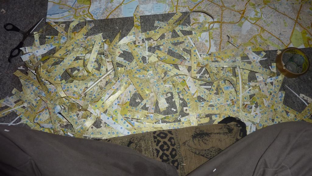
The A-Z dissection was more of a mission than any riding I've done so far, even the bloody rest days are epic! There is 154 A5 pages in total from two A-Z's. As the pages overlap I had to cut bits off each page, and so removed all the letters (A-K) and numbers (1-7) across the tops and down the sides of each page. I then lined them up as best I could with blu tac, before sellotaping across the back of the pages in strips 9 wide which made them easier to move around but not too cumbersome.
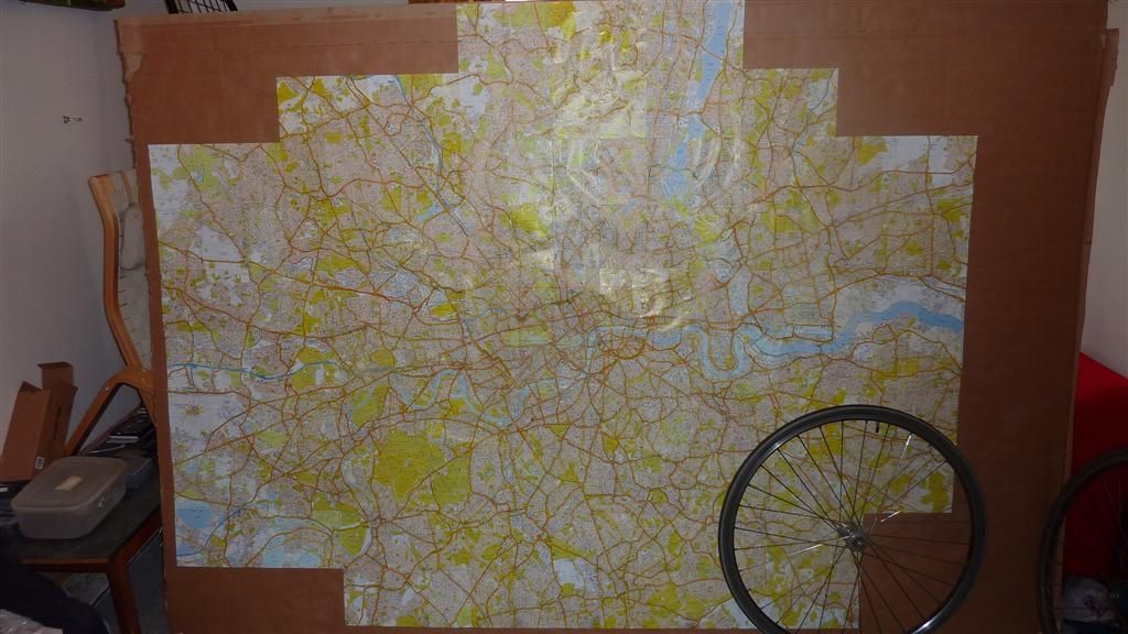
I'm very out of practice at all this Art Attack stuff so it took ages. I don't know the exact number of hours, but I was quicker cycling the 141 miles of the Victoria Line, Central and Bakerloo lines on the longest day of riding so far. I don't think I'd cut the mustard as a primary school class room assistant. It was a bit hypnotic, and over the course of two days I entered a trance like state, perhaps helped by the sweets, which were demolished in 2 sittings. So 2 small rolls of sellotape, a pack of blue tack and many hours and much squinting later, with only occasional swearing, I'm left with a map at 1:22,000 scale which is about 157cm high and 210cm wide. As yet another example of the sheer scale of the Underground, Overground and DLR network, its still not big enough, as I've ridden off the map in the northerly, easterly and westerly directions.
I'm now need some print outs from google maps or other mapping software, at the same scale, to stick these on to the A-Z map so I can draw on the tube lines in full. This will give a good visual of how far into the sticks the Metropolitan line goes, and I expect it to add another 2-3 feet to the map in a north-westerly direction. I only need a page in the west to complete the road around the Heathrow for the Piccadilly line. I need a page or two up north to Epping for the Central Line, and again a page or two out East to include Upminster on the District Line. South London, being mostly residential tundra with a scarcity of stations compared to north of the river, needs no extensions. The Overground's West Croydon being the most southerly point I've ridden to, and thats on the bottom row of the A-Z map. I don't have a printer so the extensions will have to wait for now. In the meantime I wanted to have some card to mount what I have so far.
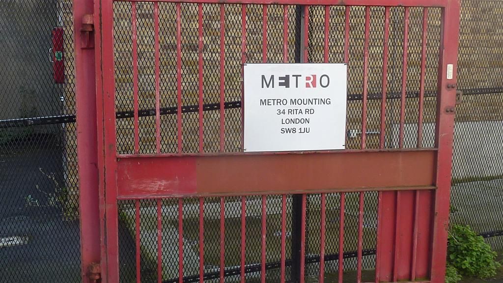
By chance pretty much right opposite the flat where I live is a company called.....
As I've cycled the Metropolitan Line and the rest of the 'Metro' cough network of the Metropolis of London, its just destiny to involve them somehow. I just need a mention in the Metro for the full house.
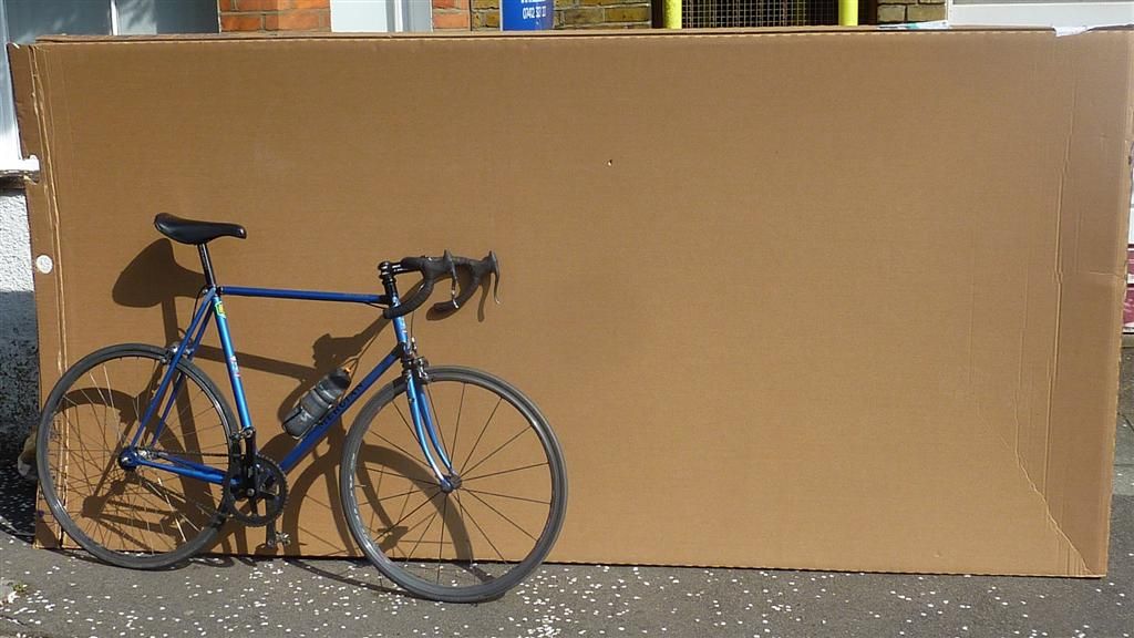
Obviously they would do a much more professional job than me, but alas I can't afford that. I popped over there this morning, told them what I was doing and asked if they had any pieces of cardboard I could have or buy from them. They very kindly gave me one of the biggest cardboard boxes I've ever seen, for nothing.
Big thanks to the guys at Metro Mounting. The box was too big to get up the stairs of the flat so I had to butcher it in the road. After more eye straining, another pack of blu tack and after pulling all the shapes used in a game of Twister, I have my first map!
The crappy indoor pic does'nt do it justice. I'm immediately struck by how much green space London has, and on a day like today I bet they were all choc-a-block with people sunning themselves.
I made one big booboo with page 57 as I taped it before cutting the numbers and letters off. I've tried to peel the sellotape off but its not having it, and will wreck the page, so I'm keeping it as it is. I quite like the fact its preserved as a record of me messing up. In case its not blindingly obvious, I should point out I'm not a creative arty type in anyway. My parents inform me I retired from art aged 5, when my 2 and half year old sister did a better drawing than me. I threw down the crayons in disgust and never returned to art again. My mum and sister both went to Art College but I ditched art at the first opportunity in high school, so my works are in very short supply. OK its not a masterpiece, but its definitely my piece. Maybe because its become such a labour intensive thing, but I'm really quite taken with this map.
I had a brief test colouring in, and as any 5 year old will tell you, colouring in over another colour does'nt always give you the colour you were expecting. All the bigger main roads on the A-Z are coloured in orange or yellow.So while the darker, bolder colours come out OK, others do not. My sister suggested I paint over the orange and yellow roads I need to colour in with a white acrylic paint, and then I can colour in on the white. I will probably then outline the colour with black biro, so the fainter lines like the yellow Circle line can be seen clearly. So after all that, the analogue version is still not remotely finished. My mum happens to have some white acrylic paint and is sending it down this week, so this map can go on the back burner for now. Its quite possible I'll make a total mess of it, but I'm enjoying it so far and looking forward to giving it a go. Its over 30 years too late, but I may finally have something to send to Take Hart, with the dream of making 'the Gallery', the under 11's equivalent of a Turner Prize nomination. I just googled Tony Hart out of interest, he passed away in 2009 aged 83. With all this Blue Peter-esque sticky tape and blu tack work I've been doing, I was pleased to discover he also created the Blue Peter ship logo, what a legend. And it makes a nice change to have a 70's TV presenter that has'nt been disgraced by Operation Yewtree.
So time to move from analogue in the digital arena. While randomly cruising the internet looking for map animation tips, as my expertise in this area amounts to the square root of diddly, I came across a random thread from 2012 from a chap in California called Chris Lamb who was wanting to plot multiple GPX tracks from sailing races onto a single map. The thread had a contact email so I pinged off a brief email explaining how I was looking for exactly the same thing, and asked if he'd had any success. The thread also mentioned 'Animaps', which I'd never heard of, but its free and seemed to do some cool stuff. Despite being contacted cold by a complete stranger from the internet, he replied back explaining how he met his needs by coverting files to KML, and then uploading them onto google earth, and he then sent me some kml traces he'd done as examples. What a complete star, thanks again Chris. I'll try that in the near future. I'm a complete amateur bumbling along, not really knowing how to do what I want, but am very grateful for all the help so far.
I have spent a few hours playing with Animaps. It only animates lines one at a time, but still looks good. It can pop up photos where you took them on route and you can change the line to any colour you want, so it meets many of my requirements. However I don't know if its possibly one of the buggiest (about the extent of my IT diagnostic descriptive powers) websites ever, or my old shitehouse notebook is having a total nervous breakdown and cannot cope with any hard work. I suspect a combination of the two. Anyway after numerous crashes and much frustration I've not got the lines as I'd like, so thats still a work in progress for now.
More importantly its time to get the riding finished, I've still not written out the route for the Piccadilly line, but am looking at doing the ride this Friday or Saturday. If anyone that wants to come has a preference for either of those let me know. I'll need to check back to the alternative route Fasih suggested through some industrial estate as I can't recall off the top of my head. I'm having an irrational fear that all the planes and Heathrow comms will interfere with my GPS tracker, make it crash and die before I've finished, condemning me to riding the Piccadilly line again. At least if I start in Heathrow and it crashes, I can give it another attempt immediately without having to stop for a lengthy blub at the side of the road, which is what will happen if it died there after starting in Cockfosters. Please feel free to reassure me this is completely nonsensical.
The BBC weather bods are currently predicting 8-12mph south westerly winds for Friday and Saturday. This combined with my GPS seizure fears means I'm favouring starting in Heathrow, and ending with a mountain top finish in Cockfosters. Its then only 10 miles or so, mostly downhill, to get back to central London. If I'm on my own I'll definitely do that route, but if others want to go the other direction I'm open to persuasion, as long as they have a GPS tracker so we can hedge our bets! And let me know soon as all the route notes will need to be different.
Including riding out and back into town it will be about 100 miles, and we have an extra hour of evening daylight so no need for any super early starts, probably aim to leave central about 9am. After starting this in early January its going to be great doing it in milder weather.
I had a weekend visiting family and friends so no time for any map activity. It was my nieces 5th birthday party on Saturday. There were about 30 children, mostly girls, mostly 4-5 but with a few younger siblings thrown in. The noise was something to behold, London traffic did not even compare, what has been heard cannot be unheard. You know this already, wherever you were in the world you surely heard them.
The A-Z dissection was more of a mission than any riding I've done so far, even the bloody rest days are epic! There is 154 A5 pages in total from two A-Z's. As the pages overlap I had to cut bits off each page, and so removed all the letters (A-K) and numbers (1-7) across the tops and down the sides of each page. I then lined them up as best I could with blu tac, before sellotaping across the back of the pages in strips 9 wide which made them easier to move around but not too cumbersome.

I'm very out of practice at all this Art Attack stuff so it took ages. I don't know the exact number of hours, but I was quicker cycling the 141 miles of the Victoria Line, Central and Bakerloo lines on the longest day of riding so far. I don't think I'd cut the mustard as a primary school class room assistant. It was a bit hypnotic, and over the course of two days I entered a trance like state, perhaps helped by the sweets, which were demolished in 2 sittings. So 2 small rolls of sellotape, a pack of blue tack and many hours and much squinting later, with only occasional swearing, I'm left with a map at 1:22,000 scale which is about 157cm high and 210cm wide. As yet another example of the sheer scale of the Underground, Overground and DLR network, its still not big enough, as I've ridden off the map in the northerly, easterly and westerly directions.
I'm now need some print outs from google maps or other mapping software, at the same scale, to stick these on to the A-Z map so I can draw on the tube lines in full. This will give a good visual of how far into the sticks the Metropolitan line goes, and I expect it to add another 2-3 feet to the map in a north-westerly direction. I only need a page in the west to complete the road around the Heathrow for the Piccadilly line. I need a page or two up north to Epping for the Central Line, and again a page or two out East to include Upminster on the District Line. South London, being mostly residential tundra with a scarcity of stations compared to north of the river, needs no extensions. The Overground's West Croydon being the most southerly point I've ridden to, and thats on the bottom row of the A-Z map. I don't have a printer so the extensions will have to wait for now. In the meantime I wanted to have some card to mount what I have so far.
By chance pretty much right opposite the flat where I live is a company called.....

As I've cycled the Metropolitan Line and the rest of the 'Metro' cough network of the Metropolis of London, its just destiny to involve them somehow. I just need a mention in the Metro for the full house.
Obviously they would do a much more professional job than me, but alas I can't afford that. I popped over there this morning, told them what I was doing and asked if they had any pieces of cardboard I could have or buy from them. They very kindly gave me one of the biggest cardboard boxes I've ever seen, for nothing.


Big thanks to the guys at Metro Mounting. The box was too big to get up the stairs of the flat so I had to butcher it in the road. After more eye straining, another pack of blu tack and after pulling all the shapes used in a game of Twister, I have my first map!
The crappy indoor pic does'nt do it justice. I'm immediately struck by how much green space London has, and on a day like today I bet they were all choc-a-block with people sunning themselves.
I made one big booboo with page 57 as I taped it before cutting the numbers and letters off. I've tried to peel the sellotape off but its not having it, and will wreck the page, so I'm keeping it as it is. I quite like the fact its preserved as a record of me messing up. In case its not blindingly obvious, I should point out I'm not a creative arty type in anyway. My parents inform me I retired from art aged 5, when my 2 and half year old sister did a better drawing than me. I threw down the crayons in disgust and never returned to art again. My mum and sister both went to Art College but I ditched art at the first opportunity in high school, so my works are in very short supply. OK its not a masterpiece, but its definitely my piece. Maybe because its become such a labour intensive thing, but I'm really quite taken with this map.
I had a brief test colouring in, and as any 5 year old will tell you, colouring in over another colour does'nt always give you the colour you were expecting. All the bigger main roads on the A-Z are coloured in orange or yellow.So while the darker, bolder colours come out OK, others do not. My sister suggested I paint over the orange and yellow roads I need to colour in with a white acrylic paint, and then I can colour in on the white. I will probably then outline the colour with black biro, so the fainter lines like the yellow Circle line can be seen clearly. So after all that, the analogue version is still not remotely finished. My mum happens to have some white acrylic paint and is sending it down this week, so this map can go on the back burner for now. Its quite possible I'll make a total mess of it, but I'm enjoying it so far and looking forward to giving it a go. Its over 30 years too late, but I may finally have something to send to Take Hart, with the dream of making 'the Gallery', the under 11's equivalent of a Turner Prize nomination. I just googled Tony Hart out of interest, he passed away in 2009 aged 83. With all this Blue Peter-esque sticky tape and blu tack work I've been doing, I was pleased to discover he also created the Blue Peter ship logo, what a legend. And it makes a nice change to have a 70's TV presenter that has'nt been disgraced by Operation Yewtree.
So time to move from analogue in the digital arena. While randomly cruising the internet looking for map animation tips, as my expertise in this area amounts to the square root of diddly, I came across a random thread from 2012 from a chap in California called Chris Lamb who was wanting to plot multiple GPX tracks from sailing races onto a single map. The thread had a contact email so I pinged off a brief email explaining how I was looking for exactly the same thing, and asked if he'd had any success. The thread also mentioned 'Animaps', which I'd never heard of, but its free and seemed to do some cool stuff. Despite being contacted cold by a complete stranger from the internet, he replied back explaining how he met his needs by coverting files to KML, and then uploading them onto google earth, and he then sent me some kml traces he'd done as examples. What a complete star, thanks again Chris. I'll try that in the near future. I'm a complete amateur bumbling along, not really knowing how to do what I want, but am very grateful for all the help so far.
I have spent a few hours playing with Animaps. It only animates lines one at a time, but still looks good. It can pop up photos where you took them on route and you can change the line to any colour you want, so it meets many of my requirements. However I don't know if its possibly one of the buggiest (about the extent of my IT diagnostic descriptive powers) websites ever, or my old shitehouse notebook is having a total nervous breakdown and cannot cope with any hard work. I suspect a combination of the two. Anyway after numerous crashes and much frustration I've not got the lines as I'd like, so thats still a work in progress for now.
More importantly its time to get the riding finished, I've still not written out the route for the Piccadilly line, but am looking at doing the ride this Friday or Saturday. If anyone that wants to come has a preference for either of those let me know. I'll need to check back to the alternative route Fasih suggested through some industrial estate as I can't recall off the top of my head. I'm having an irrational fear that all the planes and Heathrow comms will interfere with my GPS tracker, make it crash and die before I've finished, condemning me to riding the Piccadilly line again. At least if I start in Heathrow and it crashes, I can give it another attempt immediately without having to stop for a lengthy blub at the side of the road, which is what will happen if it died there after starting in Cockfosters. Please feel free to reassure me this is completely nonsensical.
The BBC weather bods are currently predicting 8-12mph south westerly winds for Friday and Saturday. This combined with my GPS seizure fears means I'm favouring starting in Heathrow, and ending with a mountain top finish in Cockfosters. Its then only 10 miles or so, mostly downhill, to get back to central London. If I'm on my own I'll definitely do that route, but if others want to go the other direction I'm open to persuasion, as long as they have a GPS tracker so we can hedge our bets! And let me know soon as all the route notes will need to be different.
Including riding out and back into town it will be about 100 miles, and we have an extra hour of evening daylight so no need for any super early starts, probably aim to leave central about 9am. After starting this in early January its going to be great doing it in milder weather.