-
• #102
Awesome lyrics there BF.
AS for availability weekends are my only free time and this weekend I'm moving. But there's no need to wait for me if you get good weather in the mean time you should head out. What lines are left then?
-
• #103
The Piccadilly line is all that remains, the grand finale and about 100 miles I think. The weather looks a bit all over the place over the next week and is likely to be the deciding factor on picking a day. Good luck with the move.
-
• #104
I'd be tempted to do the finale with you fella.
-
• #105
I had a weekend visiting family and friends so no time for any map activity. It was my nieces 5th birthday party on Saturday. There were about 30 children, mostly girls, mostly 4-5 but with a few younger siblings thrown in. The noise was something to behold, London traffic did not even compare, what has been heard cannot be unheard. You know this already, wherever you were in the world you surely heard them.
The A-Z dissection was more of a mission than any riding I've done so far, even the bloody rest days are epic! There is 154 A5 pages in total from two A-Z's. As the pages overlap I had to cut bits off each page, and so removed all the letters (A-K) and numbers (1-7) across the tops and down the sides of each page. I then lined them up as best I could with blu tac, before sellotaping across the back of the pages in strips 9 wide which made them easier to move around but not too cumbersome.
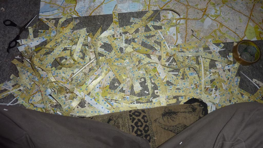
I'm very out of practice at all this Art Attack stuff so it took ages. I don't know the exact number of hours, but I was quicker cycling the 141 miles of the Victoria Line, Central and Bakerloo lines on the longest day of riding so far. I don't think I'd cut the mustard as a primary school class room assistant. It was a bit hypnotic, and over the course of two days I entered a trance like state, perhaps helped by the sweets, which were demolished in 2 sittings. So 2 small rolls of sellotape, a pack of blue tack and many hours and much squinting later, with only occasional swearing, I'm left with a map at 1:22,000 scale which is about 157cm high and 210cm wide. As yet another example of the sheer scale of the Underground, Overground and DLR network, its still not big enough, as I've ridden off the map in the northerly, easterly and westerly directions.I'm now need some print outs from google maps or other mapping software, at the same scale, to stick these on to the A-Z map so I can draw on the tube lines in full. This will give a good visual of how far into the sticks the Metropolitan line goes, and I expect it to add another 2-3 feet to the map in a north-westerly direction. I only need a page in the west to complete the road around the Heathrow for the Piccadilly line. I need a page or two up north to Epping for the Central Line, and again a page or two out East to include Upminster on the District Line. South London, being mostly residential tundra with a scarcity of stations compared to north of the river, needs no extensions. The Overground's West Croydon being the most southerly point I've ridden to, and thats on the bottom row of the A-Z map. I don't have a printer so the extensions will have to wait for now. In the meantime I wanted to have some card to mount what I have so far.
By chance pretty much right opposite the flat where I live is a company called.....
As I've cycled the Metropolitan Line and the rest of the 'Metro' cough network of the Metropolis of London, its just destiny to involve them somehow. I just need a mention in the Metro for the full house.Obviously they would do a much more professional job than me, but alas I can't afford that. I popped over there this morning, told them what I was doing and asked if they had any pieces of cardboard I could have or buy from them. They very kindly gave me one of the biggest cardboard boxes I've ever seen, for nothing.
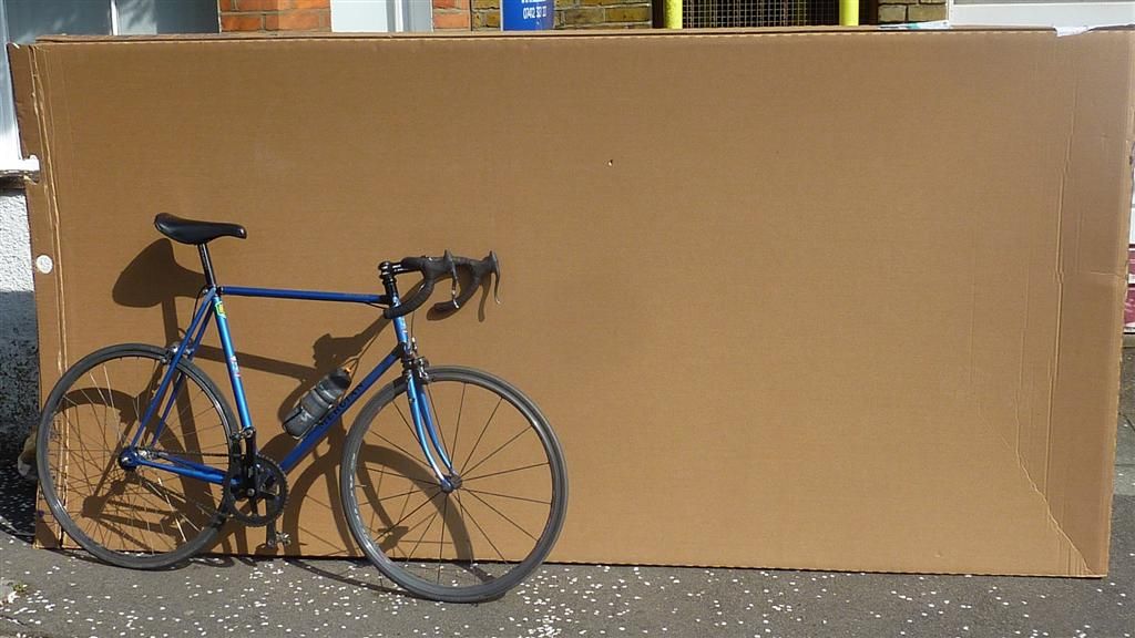
Big thanks to the guys at Metro Mounting. The box was too big to get up the stairs of the flat so I had to butcher it in the road. After more eye straining, another pack of blu tack and after pulling all the shapes used in a game of Twister, I have my first map!
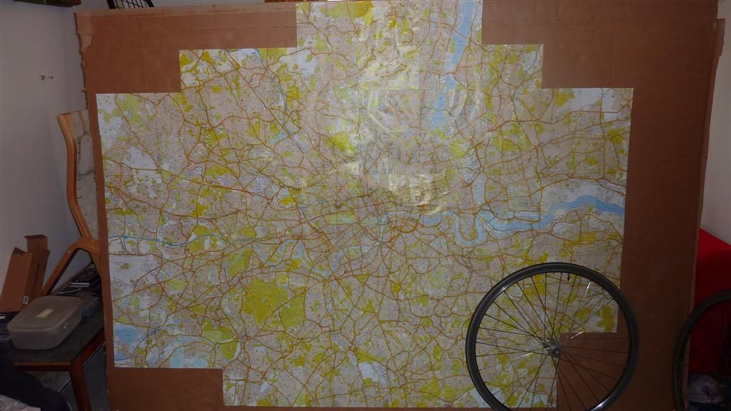
The crappy indoor pic does'nt do it justice. I'm immediately struck by how much green space London has, and on a day like today I bet they were all choc-a-block with people sunning themselves.I made one big booboo with page 57 as I taped it before cutting the numbers and letters off. I've tried to peel the sellotape off but its not having it, and will wreck the page, so I'm keeping it as it is. I quite like the fact its preserved as a record of me messing up. In case its not blindingly obvious, I should point out I'm not a creative arty type in anyway. My parents inform me I retired from art aged 5, when my 2 and half year old sister did a better drawing than me. I threw down the crayons in disgust and never returned to art again. My mum and sister both went to Art College but I ditched art at the first opportunity in high school, so my works are in very short supply. OK its not a masterpiece, but its definitely my piece. Maybe because its become such a labour intensive thing, but I'm really quite taken with this map.
I had a brief test colouring in, and as any 5 year old will tell you, colouring in over another colour does'nt always give you the colour you were expecting. All the bigger main roads on the A-Z are coloured in orange or yellow.So while the darker, bolder colours come out OK, others do not. My sister suggested I paint over the orange and yellow roads I need to colour in with a white acrylic paint, and then I can colour in on the white. I will probably then outline the colour with black biro, so the fainter lines like the yellow Circle line can be seen clearly. So after all that, the analogue version is still not remotely finished. My mum happens to have some white acrylic paint and is sending it down this week, so this map can go on the back burner for now. Its quite possible I'll make a total mess of it, but I'm enjoying it so far and looking forward to giving it a go. Its over 30 years too late, but I may finally have something to send to Take Hart, with the dream of making 'the Gallery', the under 11's equivalent of a Turner Prize nomination. I just googled Tony Hart out of interest, he passed away in 2009 aged 83. With all this Blue Peter-esque sticky tape and blu tack work I've been doing, I was pleased to discover he also created the Blue Peter ship logo, what a legend. And it makes a nice change to have a 70's TV presenter that has'nt been disgraced by Operation Yewtree.
So time to move from analogue in the digital arena. While randomly cruising the internet looking for map animation tips, as my expertise in this area amounts to the square root of diddly, I came across a random thread from 2012 from a chap in California called Chris Lamb who was wanting to plot multiple GPX tracks from sailing races onto a single map. The thread had a contact email so I pinged off a brief email explaining how I was looking for exactly the same thing, and asked if he'd had any success. The thread also mentioned 'Animaps', which I'd never heard of, but its free and seemed to do some cool stuff. Despite being contacted cold by a complete stranger from the internet, he replied back explaining how he met his needs by coverting files to KML, and then uploading them onto google earth, and he then sent me some kml traces he'd done as examples. What a complete star, thanks again Chris. I'll try that in the near future. I'm a complete amateur bumbling along, not really knowing how to do what I want, but am very grateful for all the help so far.
I have spent a few hours playing with Animaps. It only animates lines one at a time, but still looks good. It can pop up photos where you took them on route and you can change the line to any colour you want, so it meets many of my requirements. However I don't know if its possibly one of the buggiest (about the extent of my IT diagnostic descriptive powers) websites ever, or my old shitehouse notebook is having a total nervous breakdown and cannot cope with any hard work. I suspect a combination of the two. Anyway after numerous crashes and much frustration I've not got the lines as I'd like, so thats still a work in progress for now.
More importantly its time to get the riding finished, I've still not written out the route for the Piccadilly line, but am looking at doing the ride this Friday or Saturday. If anyone that wants to come has a preference for either of those let me know. I'll need to check back to the alternative route Fasih suggested through some industrial estate as I can't recall off the top of my head. I'm having an irrational fear that all the planes and Heathrow comms will interfere with my GPS tracker, make it crash and die before I've finished, condemning me to riding the Piccadilly line again. At least if I start in Heathrow and it crashes, I can give it another attempt immediately without having to stop for a lengthy blub at the side of the road, which is what will happen if it died there after starting in Cockfosters. Please feel free to reassure me this is completely nonsensical.
The BBC weather bods are currently predicting 8-12mph south westerly winds for Friday and Saturday. This combined with my GPS seizure fears means I'm favouring starting in Heathrow, and ending with a mountain top finish in Cockfosters. Its then only 10 miles or so, mostly downhill, to get back to central London. If I'm on my own I'll definitely do that route, but if others want to go the other direction I'm open to persuasion, as long as they have a GPS tracker so we can hedge our bets! And let me know soon as all the route notes will need to be different.
Including riding out and back into town it will be about 100 miles, and we have an extra hour of evening daylight so no need for any super early starts, probably aim to leave central about 9am. After starting this in early January its going to be great doing it in milder weather.
-
• #106
Someone on the bike tag thread published an animated map of all the tags. They used the R statistical programming language. Might be worth a look.
As for drawing on the pages, what about mounting some perspex on top of the pages and drawing on that? Gives you the opportunity to correct mistakes etc -
• #107
Thanks Russell, I like the sound of being able to 'lift' the coloured lines off the map to show the full network without the backing map. I suspect bits of perspex that size will be pretty costly, but thin clear acetate sheets would also work well enough, so I'll look into that.
Programming is way beyond my powers, but my housemate is an expert at that stuff, though he's been away in Wales for a few months. But I'll ask him about R statistical programming language, as thats the first I've even heard of it. I do remember seeing the BTOB animations and they were pretty good. I'll trawl back through that thread and have another look.
-
• #108
Finished! Yesterday I completed the riding part of this mammoth mission. This was followed by some well earned celebratory beers, so I did'nt get round to writing it up yesterday..
After tweaking my original draft route and writing out the notes for the Piccadilly line, which took ages as usual, I really could'nt be arsed to plot a scenic route to Heathrow. So I braved the rush hour along the A4. I've done just about every other horrible junction in London, so why not.
The terminals are'nt in order so I decided to go round the whole site, starting at Henlys roundabout, where I took an inverse Scoblebrick photo.
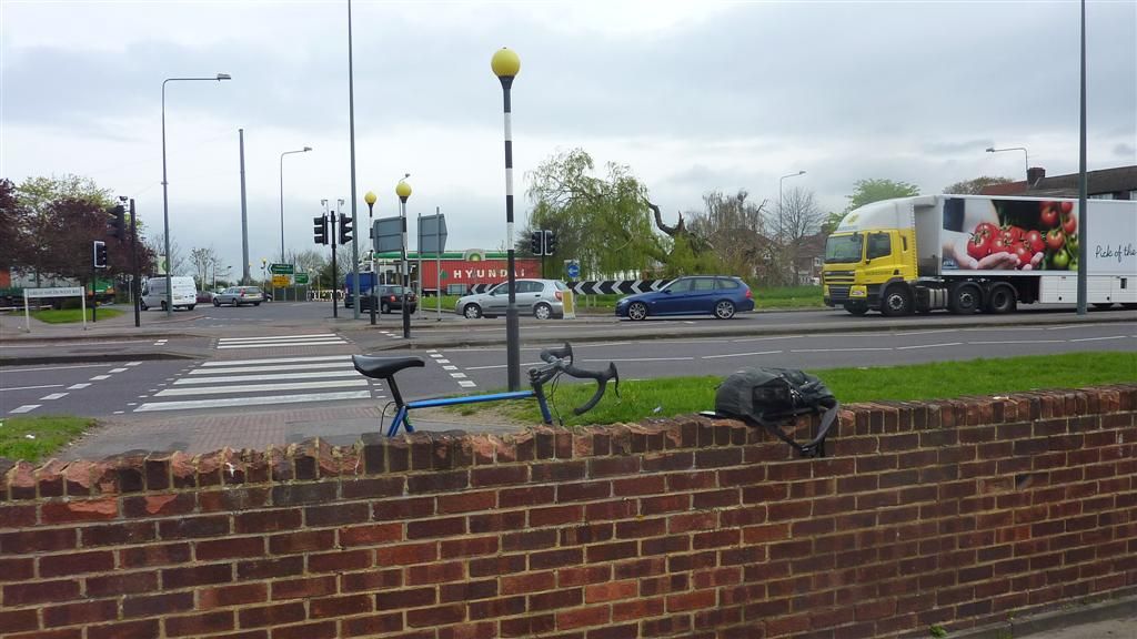
My notes said to turn right to Terminals 1,2 &3 when I got to Nene Road, despite the signs suggesting I should turn left. I overruled common sense and went right, and spent a mile or so overruling my inner homing pigeon, before admitting defeat and turning around. Immediately after here:
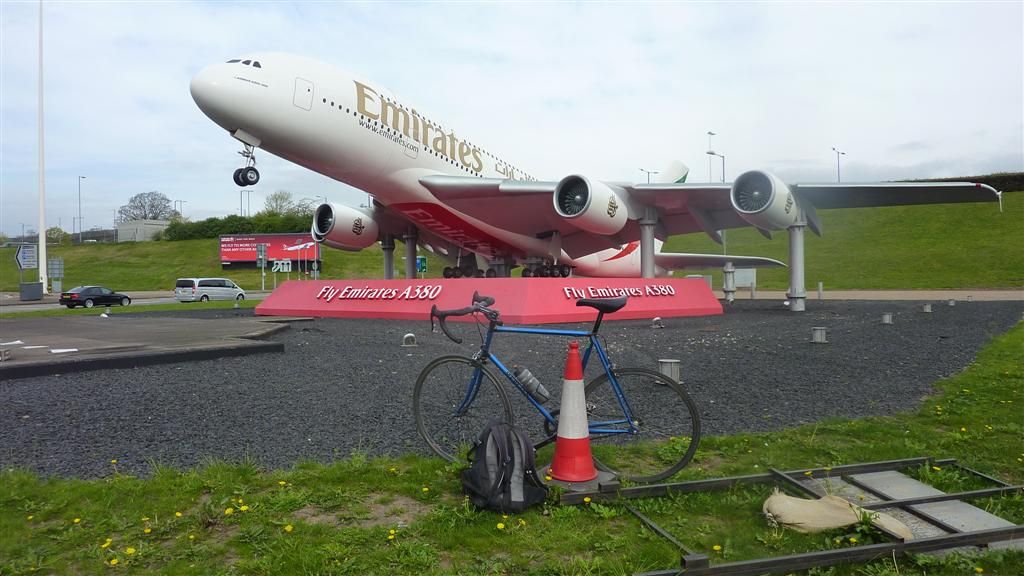
there was a really good cycle tunnel which would make a great drag strip for some cycle sprints.
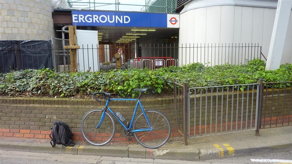
The first of 53 stations for the day
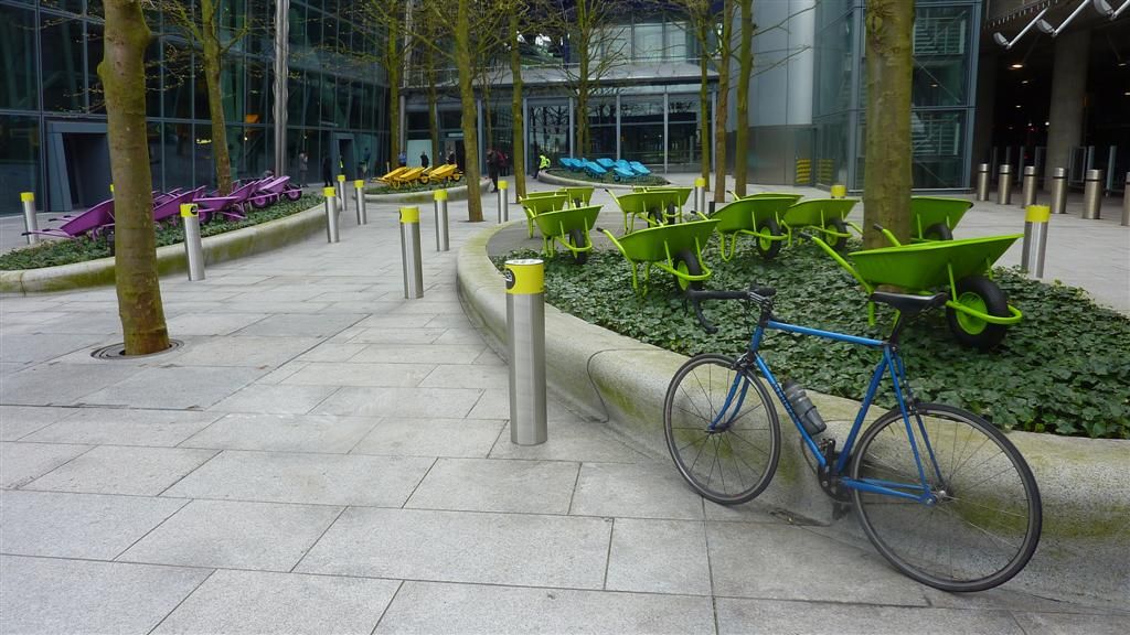
Lucy and the sky with wheelbarrows installation at Terminal 5
After Terminal 5 I had the wind on my back and blasted round the rest of the site before a sarnie break at Hatton Cross. I say blasted, but looking the speed it says I barely broke 10mph?? Anyone else notice any issues with the speed on the Ridewithgps site recently? My ride out to Heathrow had a higher average speed than the top speed, err how? Over the course of the Piccadilly line it said my max speed was 16.8 mph, pfft. Looking at the 'time spent at each speed' graph I spent 35 minutes doing 17mph, 26 mins at 18mph, 16mins at 19mph, so something is obviously wrong there. I don't have a speedometer and like to think I'm not bothered by speed, but this is obviously not strictly true. It was especialy crushing to see such lowly speeds as I thought I'd made really good time on this line overall.Shortly after Hounslow East I cut up a ped path up the side of the rail tracks, it was like the path the council forgot. It had the worst surface of anything I'd come across and had a street light fallen across the path. I felt like the first person up there for years.
I cut through a nice calm section after Park Royal, which had a few wiers, and a nice circular path through some gardens with various ponds.
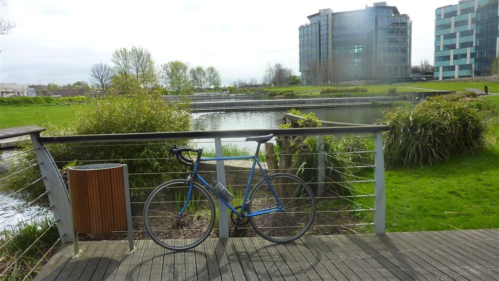
But there was construction work on 3 sides and they'd put up hoardings blocking all the exists so struggled to find a way out. I then pressed on to Uxbridge which was rather boring as I'd ridden this stretch already.I sat on the benches for a peanut butter sarnie in Uxbridge and got chatting to a little old pensioner lady, who really made me laugh. She said she'd only left the house to buy some bread, had bought some but by the time she'd got back to bus stop realised she now longer had it, and must have put it down somewhere, so had to go and buy some more. The old grey matter is not what it once was she mused. As we were chatting a tattooed and heavily pierced rocker aged about 50 asked if he could squeeze in between us, and we all had a chin wag together. It must have looked like a scene from a comedy sketch or the beginning of a joke. We chatted about the weather (of course), the removal of benches to sit down on at Uxbridge tube/bus station, without a corresponding increase in buses. I told them what I was doing and they both wished me luck and a safe journey, before their bus arrived and they were gone. That perked me up for the leg back to Acton Town, and from there, no more branch lines, thank ye gods for that.
I had a near miss as a women and her two young children, not in the mood for waiting for the green man tried to make an impatient dash across the 3 lanes of Coventry Street by Piccadilly Circus, until I bellowed out a NOOOO! which almost made her jump out of her skin. Honestly of all the places to try such a move, she should be reported to Social Services. Otherwise the section through Central London went quickly and without incident.
I did a nice cut through a previously unridden section of path to Krapyrubsnif, onto the always congested Green Lanes before climbing up to the finish in Cockfosters. I was pretty pleased with my route today. It probably had the most paths and sections not on Streetview of any line ridden so far, and had loads of bits I've not ridden before, so I was a bit apprehensive about getting lost, especially as I don't have an A-Z anymore after cutting mine up last week to make my ginormous map. There were only 1 or 2 very slight errors but I don't think I strayed off course by more than 200 metres all day.
Before starting this project I'd never heard of Charles Holden, but he deserves a mention. He designed many London Underground stations in the 1920's and 30's, and many other buildings including Bristol Central Library and UCL's Senate House. Many of his building, including the stations have been granted listed status. The Piccadilly line perhaps best showcases his designs. Here's just 2 examples.
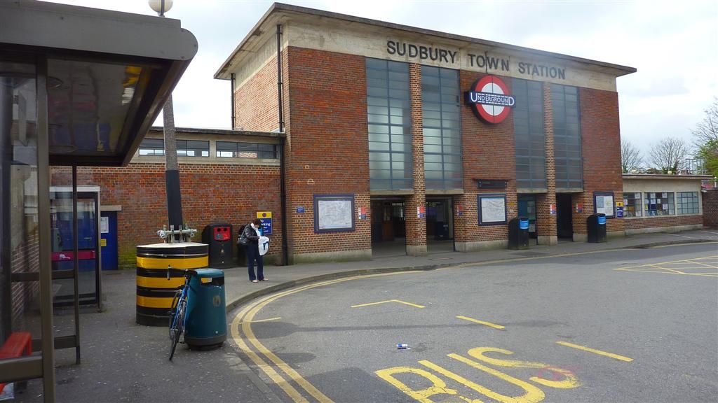
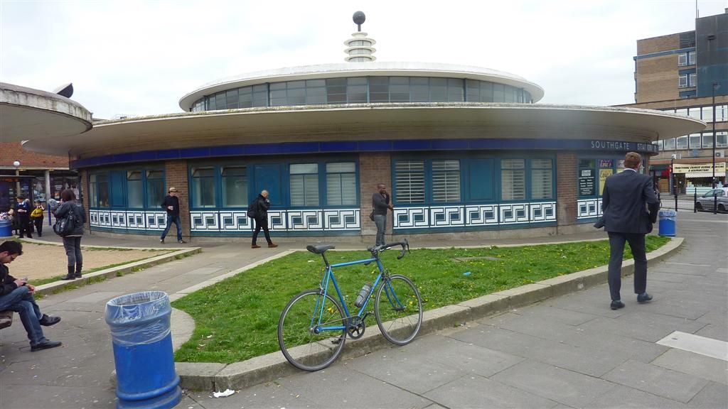
Personally I much prefer the curves of the flying saucer like station at Southgate
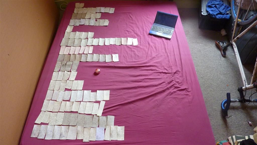
The Piccadilly line came out at 78.2 miles, so just shy of the Central lines 79.1 miles. Total mileage for the day, excluding the bicycle tag jaunt which came later, was 107.6 miles. Total mileage for the entire project is 913.4 miles over 11 days riding from January to April. Despite the Bakerloo line shambles, I'm perhaps most pleased that I did it all without a sat nav, and did'nt let that deter me from chosing winding back routes all over the place. I'm sure you've never wondered what the written directions for such an undertaking look like, but I'm going to show you anyway. Each row represents a line, in the order I rode them.
Perhaps the most surprising thing is despite my tyres being pretty thrashed I've only had 1 puncture to slow me down. Perhaps the least surprising, for us at least, is that for speed, flexibility, efficiency, value, and enjoyment, the bicycle is by far the best way to get around London, and I love mine a little more.In case anyone asks if I fancy doing the bus network, the answer is a resounding NO. I've done a big stint of city riding and am looking forward to some quiet country lanes.
Underground
18th January Victoria line- http://ridewithgps.com/trips/2168039
16 stations
18th Jan Central line- http://ridewithgps.com/trips/2168037
49 stations
18th Jan, 26th & 27th Feb Bakerloo line- http://ridewithgps.com/trips/2284876
25 stations
21st Jan Jubilee line- http://ridewithgps.com/trips/2179359
27 stations
21st Jan Metropolitan line- http://ridewithgps.com/trips/2179362
34 stations
22nd Jan Waterloo & City line- http://ridewithgps.com/trips/2181152
2 stations
22nd Jan Circle line- http://ridewithgps.com/trips/2181146
36 stations
21st Feb District Line- http://ridewithgps.com/trips/2259166
60 stations
21st Feb Hammersmith & City- http://ridewithgps.com/trips/2259143
29 stations
26th Feb Northern line- http://ridewithgps.com/trips/2282509
50 stations
4th April Piccadilly Line- http://ridewithgps.com/trips/2430829
53 stationsOverground
15th Mar Overground 1 Stratford, Willesden Junc, Ricmond, Willesden, Clapham Junction- http://ridewithgps.com/trips/2345908
28 Stations
14th Mar Overground 2 Clap Junc, New Cross, West Croydon, Highbury & Islington- http://ridewithgps.com/trips/2341571
29 stations
13th Mar Overground 3 Gospel Oak to Barking- http://ridewithgps.com/trips/2338449
12 stations
13th Mar Overground 4 Euston to Watford Junction- http://ridewithgps.com/trips/2338455
19 stationsDLR
23rd Mar Docklands Light Railway- http://ridewithgps.com/trips/2380539
- 45 stationsI can now concentrate on making the maps.
-
• #109
Bravo! Sorry I couldn't make it along yesterday. Enjoy the map making :)
-
• #110
Cheers mate. I hope you enjoyed your rest and you heal up properly. And if your pigeon problem is unresolved let me know. My sisters work had a major issue with them, they are a healthfood co-op so wanted to solve the problem without resorting to the councils evil plan of spraying the eggs or something. I don't know what the end solution was but can find out if you like.
-
• #111
Heh cheers. The pigeons are allowed to stay until their (fugly) young can leave under their own steam. They won't be readmitted however :)
Hope you are having day off? Or maybe you fancy the bridges ride tonight, if you haven't totally lost patience with urban riding...
-
• #112
I inexplicably woke up at 6am this morning despite not going to bed till after 1am, so I expect I will be asleep before that ride even starts :) Have fun though.
-
• #113
-
• #114
Chapeau, Dan.
I've enjoyed this from the beginning, top thread, and am delighted you've chosen not to be a bus wanker. That would be a step to far I fear.
-
• #115
Cheers Andy, and knowing how you don't exactly ladle out acclaim, that is high praise indeed.
-
• #116

-
• #117
I did have a play around with Animaps but its the buggiest website ever and repeatedly make my computer crash. I'd have thrown my computer at the wall in frustration if I'd continued with it any longer. If it worked properly it had potenital, but the site seems a work in progress rather than the finished article so I've given up on it.
I went to my local library to look at some road maps to get print outs of my missing roads. I got lucky as they had a jumbo A-Z which covered more than my A5 versions, so I used the photocopier to complete the missing sections of the District Line, Central Line, and the tiny bit of the Piccadilly line around the western end of Heathrow. It also had some of the Metropolitan line, but only as far as Chorleywood. Like me it seems the folks at A-Z HQ consider including Amersham and Chesham a bit of a stretch.
The problem with the jumbo A-Z was the scale was different, my A5 A-Z's has a scale of 4.55cm to 1km, whereas the jumbo one had a scale of 5.26 cm to 1km. Luckily the library had a photocopier that did re-sizing so after some quick sums I was ready for some downsizing. The copier did'nt do fractions of a percent so the rescaling would be out by 0.5%, but thats close enough for my purposes. The section from Chorleywood to Amersham and Chesham was going to be more problematic as none of the library maps had any decent detailed pages of this wilderness area. I'd probably have had better luck getting similar scale maps of Antarctica or the moon. I return home for another session with the scissors. The copies are in black and white as I'll be colouring them in, so the overall amatuerish appearance is maintained.
That evening my mum phoned to say she'd read in one of the Sunday papers about an exhibition in the Museum of London about Phyllis Pearsall, the inventor of the A-Z. I looked it up only to discover is was only on for a few days, and the last day was in fact that day, arse marbles. Oh well, I would have liked to have seen that. Anyway having never even heard of her, I googled for more info and she sounded a right charecter, who led an interesting life, worth looking up.
The story goes she come up with the idea of the A-Z after trying unsuccessfully to find her way to a party using some OS maps. Finding the existing maps wholly unsatisfactory she set about, the very next day is it said, making her own version. She claimed to have walked 3000 miles up every street in London, sometimes up to 18 hours a day. It does'nt say how long it took her, but walking pace is an average of 3mph so thats about 1000 hours, which is bloody epic and puts my efforts to shame. She should have used a bicycle. It also turns out her life has recently been made into a musical, starring Izzie Suttie of Peep Show fame, not that I'll be seeing that as I hate musicals. My googling also revealed she had a blue plaque in her honour, at her place of birth, 3 Court Lane Gardens, East Dulwich. Now phones are smart and everyone has maps at their fingertips the A-Z is not as invaluable as it once was, but I decided to take a pilgrimage up there for a photo. It would have made a good tag on this forums Bicycle Tag thread, but I did'nt know the current one so did'nt bother.
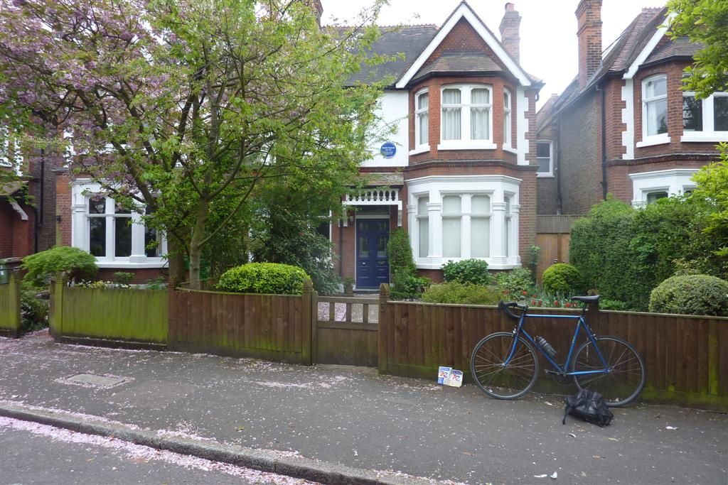
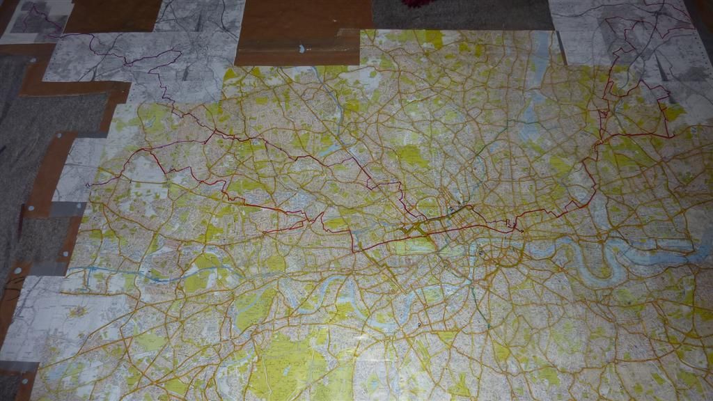
So I decide to try some print outs from google maps to get the roads out to Amersham, so I'm back round the library again. Typically enough none of the google maps 'zooms' are the same scale as the A-Z, so I do some printing and am again resizing on the photocopier. I finally have the right scale but the roads are very different in size to the A-Z, so its back home where I paint the over the roads in white, making them the same width as the A-Z version. Bloody hell this whole thing is much more of a faff than I'd hoped. I then cut up some more cardboard for the new roads and gaffer tape then onto my existing map. The results are pretty shoddy but an improvement, and I finally have a full map at 1:22,000 scale . It is a shade over 3 metres wide and nearly 2 metres high. Its now like the story of the bloke who rebuilt his car in his living room and then realised he can't get it out of the house. The flats got stairs that double back on themselves so the map is to big for me to take outside to photograph in the sun. My eyes almost bled lining that bastard up, so that's not a job I'm volunteering for again in a hurry.The next day I decided to go to Stuart R Stevenson on Clerkenwell Road, to see if they had any acetate and some permanent markers so I could trace the lines as Rhowe suggested. Not being an arty type this of shop is totally off my normal radar, and what a proper Aladdins cave it is, much more than a grown ups colouring in shop. I confessed my artisitic ignorance as soon as I walked in the door, and the two guys there could not have been more helpful. I told them what I was doing, they steered me away from the expensive roles of acetate (£180 for a 10m roll! Who knew clear plastic could be so expensive). The guy behind the counter then got out his A-Z and we must have spent 15 minutes testing a huge range of pens on the cheaper acetate to get good colour matches for each line, so a massive thanks to them.
It was then back home to start the epic tracing.
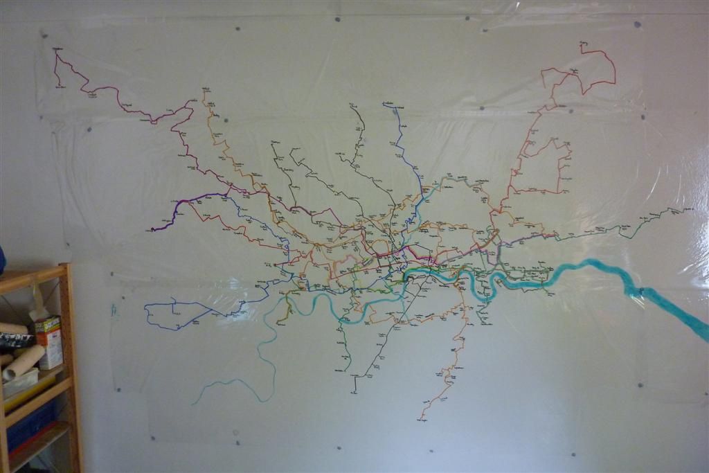
Some of the pens are a bit wishy washy looking, so for the Jubilee and the DLR I have to outline them in dotted black lines to make them stand out a bit more, and the overground I decide to do in a solid orange line. This takes a couple of days. I have'nt been able to write on all the stations, the bit in central London is just too congested. This really brings it home much of a masterpiece Harry Becks design is, his whole maps fits on the back page of my A5 A-Z. and I can't fit all the station names on a map 3 metres across! There are one or two slight station name changes, Wimbledon becomes Wombledon, as a Spurs supporter Arsenal is shortened to Arse and I can't resist calling Lewisham, Lewishambles. I also trace in the river Thames in a clear blue that makes it look like a lagoon in the Caribbean, I did say I was going to take artistic licence with that.I then take it off the A-Z cut out and temporarily blutac it on the livig room wall so I can get a good look at it on a white background. The cheap acetate is only marginally thicker and stronger than clingfilm so I'm terrified of tearing it after all the effort so far, and I spent nearly an hour trying to get the tiny sodding creases out but don't manage it completely. At a later date when I can afford it I will try and get a big single sheet of acetate so it looks better. It still looks good and I'm pretty pleased with it, though as usual my crap compact camera does'nt do it justice. I plan to finish it off by having a header along the top with the London Overground, Underground and DLR roundels and add a simple matchstick drawn bicycle to illustrate I've ridden it. My brother has a decent SLR so I'm going to borrow that to try and take some better pictures.
I then head off to WH Smith to get some white stickers to add to the map for the stations that have connections to other lines. Incidentally WH Smith were the first company to take Phyllis' A-Z, setting her on the road the fame and fortune. True to recent form they don't have any small white stickers, only coloured ones.So its back home to paint them white, before drawing black bicycle wheels over the white. I can't find anything small enough to draw round so in keeping with the sketchyness so far I do it freehand. I can't build real wheels and its clear I can't draw them either.
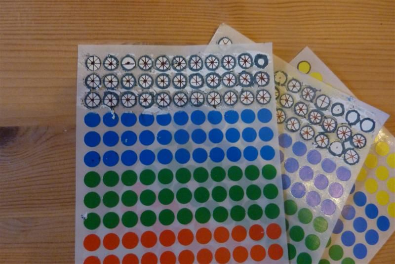
Once on they're unlikely to come off without trashing the map so I'm putting this on hold for now until I'm sure I'm going to use them. I still have'nt started painting over the orange and yellow roads on the big A-Z map to make the coloured lines stand out more so that's another big task.As part of a longer term project I hatched on the idea for a short film clip. I thought maybe a crimewatch type reconstruction, where I can move a tiny bicycle along the big A-Z map, like some WW1 General moving battalions around a massive map. I need a small model bicycle, The problem is I need a really small one, the size that would be considered too easily swallowed by a young child, therefore finding a toy one in the correct size would be unlikely. Praise be for the interwebs as I then stumbled across a tiny Hornby model bicycle to allow train nerds to achieve the complete village scene in their girl free attics or sheds. After calling 9 different Hornby stockists in London with no luck, I was beginning to feel like J.R Hartley trying to locate his version of Fly Fishing. l finally struck gold, in who'd have thought it, a train model shop run by a woman, Jane's Trains in Tooting. They agreed to hold it for me as I raced down there, and secured my first bike purchase in years. A pack of two red bicycles, complete with flat bars and front basket, obviously part of the the Hornby hipster range.
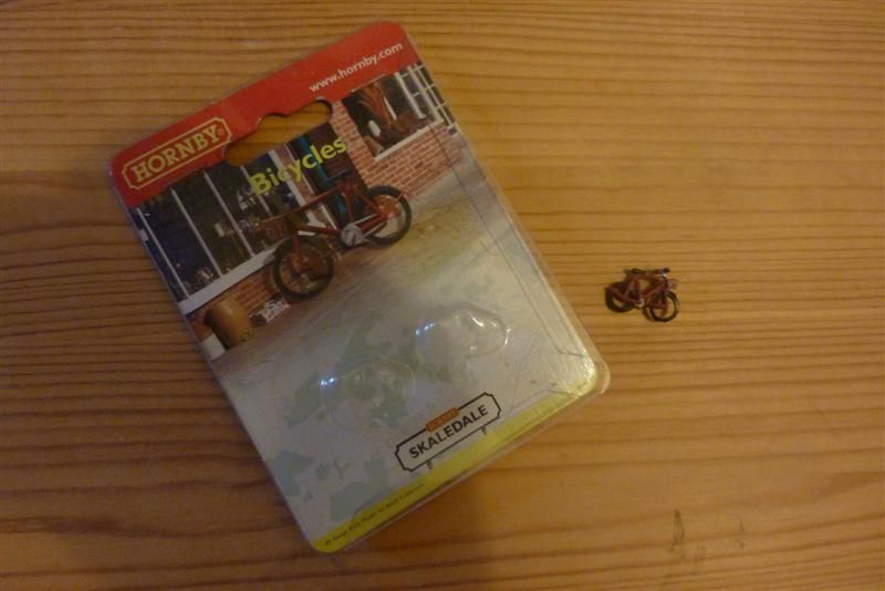
The bars and basket I could live with, but my main gripe was they were'nt blue. So, yes, its back home and out with the white paint again as undercoat, I dont have any blue paint so its felt tips to get acceptable blue livery for this most minute of steeds. As the wheelbase was only 2cm this involved brain surgeon levels of fiddlyness, but I'm happier now. I did'nt fancy my chances of finding any atom sized Mercian decals so settled for plain blue.
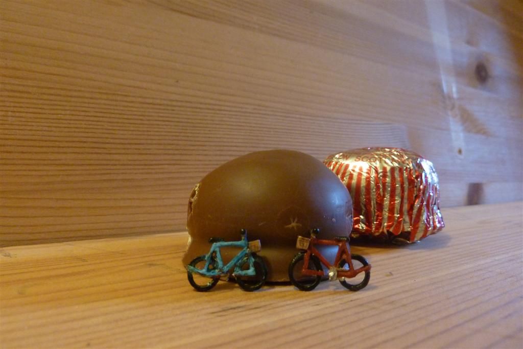
On the teacake theme I realise I've come this far without even going into the specifics of teacake eating, which is long overdue. As far as I'm aware there are 3 main methods of eating them, which psychologists can probably map a complete personality profile from. 1. There is the wolf it down in one approach. I don't so this, I'm not a complete savage. 2. Prise the top mallow and chocolate bit off with your teeth, then have the biscuit base afterwards, ideally with a swig of tea (this is my preferred method) and 3. The nibble the chocolate coating off in meticulous fashion, taking care not to remove the mallow, which is eaten second, and finishing off with the base. Far too time consuming and OCD I say. Ahem sorry, that bit of housekeeping is now out of the way.I plan to attach my tiny bicycle to an unravelled metal clothes hanger to complete my first prop. I need some more props and need to build a botched jig for my battered old gopro to film it, then come up with some of script or commentary. I'm off to Wales again this week for a stag do and visiting friends and family, so this is all being put on ice for now, back soon.
-
• #118
You are mental. In the nicest possible sense.
-
• #119
Best post on the forum today, or this week, or this month.
-
• #120
This is all rather good, Phyllis Pearsall would have been delighted. Love the Heath Robinson approach. Chapeau.
-
• #121
Oh, and ...
She claimed to have walked 3000 miles up every street in London, sometimes up to 18 hours a day. It does'nt say how long it took her, but walking pace is an average of 3mph so thats about 1000 hours, which is bloody epic and puts my efforts to shame.
I think I've read on the Internet that this is a myth. It may be a myth that it's a myth, though.
-
• #122
^ Ahh I had heard she could be a bit economical with the truth so who knows.
I also saw a comment that she wrongly named a few streets in an early edition, instead inserting family members names, so that if anyone dared copy it she could prove it was a copy. Again I don't know if this is true or not but it adds to the legend.
-
• #123
Standard cartographer's move:
-
• #124
This is all rather good, Phyllis Pearsall would have been delighted. Love the Heath Robinson approach. Chapeau.
^ Ahh I had heard she could be a bit economical with the truth so who knows.
I also saw a comment that she wrongly named a few streets in an early edition, instead inserting family members names, so that if anyone dared copy it she could prove it was a copy. Again I don't know if this is true or not but it adds to the legend.
She left out Trafalgar Square in the early edition
(I learnt this from seeing the musical *The A-Z of Mrs P *) -
• #125
That's really looking marvellous. Top work.
 CheBeef
 blue_fleet
 Howard
 rhowe
rhowe
 andyp
andyp BigH
BigH Oliver Schick
 skydancer
Thanks rhowe. Pretty timely. Having done the A-Z dissection it obviously does'nt go out as far as Amersham and Chatham, which I want to include at the correct scale. The A-Z's I have use a scale of 1:22,000, which is not a scale used any of the google maps zooms in (wording?) so I'm looking to print out some pages of the roads out that way in that scale, so maybe I'll find them there.
Continuing my usual think of a idea without any idea of how to do it method, I've been getting all excited about doing a possible animation. As I've GPS tracked every bit of riding I've done on this so far, its got to be possible to animate it all together. So say have a flashing blue dot, (me) riding along, and when I get to the start of a line I leave a 'snail trail' in the colour of the tube line, Victoria blue, Northern black etc. Speeded up obviously, but this could show the evolution of the map in the order I've ridden it, and with a bit of music added will be bloody brilliant. So I'm determined to try and make that a reality somehow.